Digital-Desert : Mojave Desert
Intro:: Nature:: Map:: Parks:: Points of Interest:: Ghosts & Gold:: Communities:: Roads & Trails:: People & History:: BLOG:: Weather:: :?:: glossary


--
Day Hikes in Death Valley

Salt Creek Trail

Interpretive Trail

Length : .5 mile round-trip.

Difficulty : easy

Description : Boardwalk along small stream. Good for viewing rare pupfish and other wildlife. Best in late winter/early spring.

Start : Salt Creek parking area, 1 mile off Hwy 190 on graded gravel road 13.5 miles north of Furnace Creek.

Also see:

    Salt Creek Photos

    At the bottom of Cottonball Basin runs Salt Creek, home of the ...

    Salt Creek

    Salt Creek is a small, short permanent stream with highly variable discharge that has its origin in springs ...

    Pupfish - Death Valley Wildlife

    Tiny pupfish are ther remnants of- and living clues to- Death Valley's once wetter past. ...

    Desert Creeks & Streams

    Creeks and sreams are smaller than, and often tributary to a river, and may be intermittant.
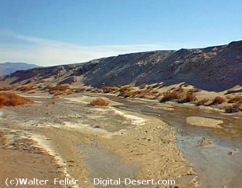

Salt Creek

--
Intro:: Nature:: Map:: Parks:: Points of Interest:: Ghosts & Gold:: Communities:: Roads & Trails:: People & History:: BLOG:: Weather:: :?:: glossary
Digital-Desert : Mojave Desert
Country Life Realty
Wrightwood, Ca.
Mountain Hardware
Wrightwood, Ca.
Canyon Cartography
G.A. Mercantile


Grizzly Cafe
Family Dining


Abraxas Engineering
privacy

Disclaimer: Some portions of this project were developed with assistance from AI tools to help reconstruct historical contexts and fill informational gaps. All materials have been reviewed and fact-checked to ensure accuracy and reliability, though complete precision cannot be guaranteed. The aim is to provide dependable starting points and distinctive perspectives for further study, exploration, and research.

These materials are historical in nature and intended for educational use only; they are not designed as travel guides or planning resources.
Copyright - Walter Feller. 1995-2025. All rights reserved.