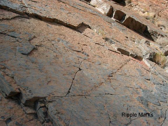
Titus Canyon/Ripple Marks
GF2g. Location/Access:(36o 49.664N; 117o 07.106W) The ripple marks are located 0.6 miles down canyon from the previous site, 19.5 miles from the highway. They are on the left side of the canyon, right at eye level, on the surface of the limestone which is dipping towards you and down to the left. The road at this point is making a broad turn to the right.
Best Time: Anytime.
Geology: While ripple marks are common in sandstone and shale, they are less common in limestone. Oscillation ripples are symmetric and are generated by water moving back and forth over loose sediment. Current ripples are asymmetric and are generated by water moving in one direction over the loose sediment. The steeper side of the ripple is down-current. These are current ripples and the current obviously came from the upper right. However, everything thing here is upside down! Thus to interpret from which direction the current actually came, one has to reconstruct the original position of the layer before folding. Then one must also consider that the whole region has been faulted and rotated by extensional tectonics. This would be a tremendous task.
=-=