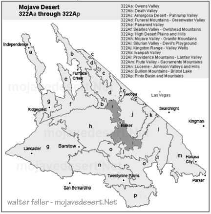
Subsection 322Ai
Silurian Valley - Devil's Playground
The Devil's Playground and Silurian Valley are remote, arid locations in the Mojave Desert. The valley stretches from the Amargosa River in the north to the Mojave River in the south, and to the southeast lies the Devil's Playground, renowned for its rolling dunes. The terrain is mostly dry plains, hills, and lake beds, that occasionally fill with water after rare storms.The climate is extremely hot and dry, with only a few inches of rain each year. Freezing temperatures are uncommon; the land quickly absorbs or sheds any falling moisture. Water rarely flows above ground, but runoff from the Mojave River may reach Soda Lake in exceptionally wet years. In the distant past, the Mojave and Amargosa Rivers once flowed through this valley, connecting to Death Valley's ancient lake system.
Despite the harsh environment, desert plants thrive here. Creosote bushes dominate the landscape, covering hills and open plains. Lower areas support saltbush and iodine bush, while dunes provide a home for desert sand-verbena. Joshua trees appear in some areas, and mesquite trees grow where underground moisture lingers longer.
Wind and occasional floods slowly shift the land, shaping it. The Devil's Playground dunes constantly change, while dry lake beds crack under the relentless sun. Though seemingly empty, the area has subtle signs of life, from hardy plants to animals that emerge at night.
The Devil's Playground and Silurian Valley are vast and serene areas that tell us of the natural beauty of the desert. Stretched out with rolling landscapes and moving sands, they are pristine and isolated, reminding us that nature can thrive even in the most extreme conditions.
Amargosa River
Mojave River
Creosote bush
Joshua tree
Mesquite series.
Death Valley
Mojave River
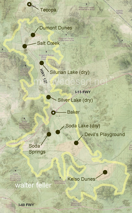
Soda Lake
< previous - Mojave Desert - next >
Baker
Zzyzx/Soda Springs
Soda Lake
Silver Lake
Silurian Lake
Devil's Playground
Kelso Dunes
Salt Springs/Creek
Fossil Shell Layers
USGS Archive
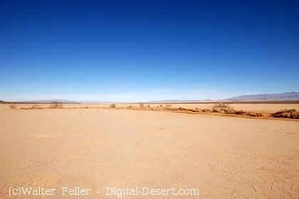
Silurian dry lake