Mono Lake Volcanic Field
The Mono Lake volcanic field east of Yosemite National Park and north of the Mono Craters consists of vents within Mono Lake and on its north shore. The most topographically prominent feature, Black Point, is an initially sublacustral basaltic cone that rises above the NW shore and was formed about 13,300 years ago when Mono Lake was higher. Holocene rhyodacitic lava domes and flows form Negit and parts of Paoha islands off the northern shore and center of the lake, respectively. The most recent eruptive activity in the Long Valley to Mono Lake region took place 100-230 years ago, when lake-bottom sediments forming much of Paoha Island were uplifted by intrusion of a rhyolitic cryptodome (Stine, in Bailey et al. 1989). Spectacular tufa towers line the shores of Mono Lake.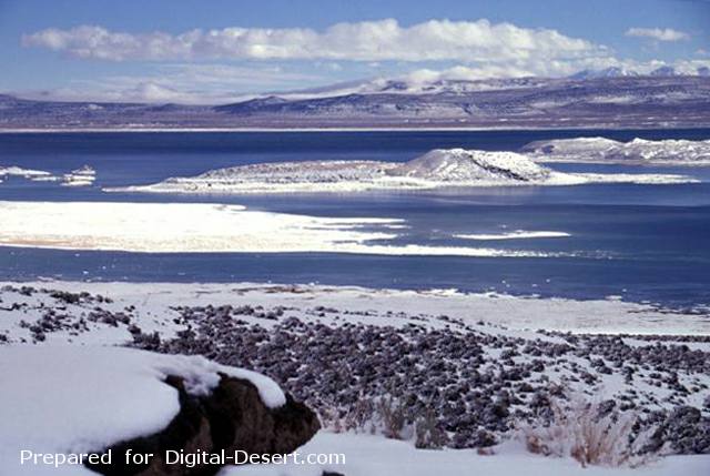
Negit (right-center) and Paoha (far right) islands in Mono Lake are seen from Black Point, a basaltic cone on the NW shore of the lake. The most recent eruptive activity from the Mono Lakes volcanic field took place 100-230 years ago, when lake-bottom sediments forming much of Paoha Island were uplifted by intrusion of a rhyolitic cryptodome. Black Point is an initially sublacustral cone that formed about 13,300 years ago when the lake was higher. The White Mountains form the far right horizon.
Photo by Lee Siebert, 1997 (Smithsonian Institution).
Country: United States
Subregion Name: California (USA)
Volcano Number: 1203-11-
Volcano Type: Cinder cones
Volcano Status: Tephrochronology
Last Known Eruption: 1790 ± 75 years
Summit Elevation: 2121 m 6,959 feet
Latitude: 38.00°N * 38°0'0"N
Longitude: 119.03°W 119°2'0"W