Impassable Pass - Spanish Canyon
Spanish Canyon
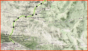
For travelers crossing the central Mojave, the land did not organize itself by county lines or modern road numbers. It organized itself by water, grade, and the plain fact that wagons only tolerate so much sand, stone, and pitch. That is why the Fork of Roads mattered. East of todays Barstow, multiple historic routes converged at this junction and then funneled toward the Mojave River corridor, where dependable water and a clearer line of travel pulled people west.
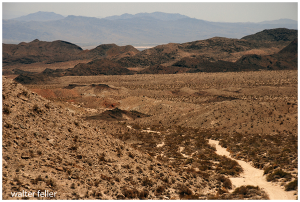
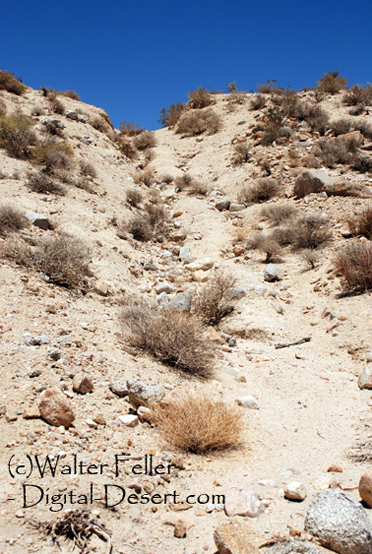
One of the most memorable obstacles on that approach is the gap commonly called Impassable Pass, tied to the Old Spanish Trail and later wagon use on what became known as the Mormon Road. From the Bitter Springs area, the route angled toward Alvord Mountain, climbed a steep, cut-up grade, and then dropped through Spanish Canyon toward the Mojave River. Edward Leo Lymans study of overland wagon travel treats this segment as a late-stage push to reach better feed and water after days of marginal springs.
On the ground, what grabs your eye is the wear. Deep ruts, carved by decades of wagon travel, still mark the line in places. The pass also sits at the edge of the modern Fort Irwin training lands. Digital-Deserts field summary notes that large boulders have been placed at the top to prevent modern vehicle access, effectively turning a hard historic grade into a near stop sign.
This is where careful wording matters. The routes importance and general alignment are well documented, but some modern explanations are not. If you mention who placed the blocking boulders, or interpret nearby rock features as signal rings or similar, present that as local tradition unless you can point to an archaeological record, a survey report, or Fort Irwin land-management documentation.
In the bigger picture, Impassable Pass is a good example of how Old Spanish Trail Mojave crossings relate to later named routes. The National Park Service notes that the Mojave Road is considered a branch of the Old Spanish National Historic Trail and is listed on the National Register of Historic Places.
Seen the old-fashioned way, the scene is simple and honest: a junction where routes braid together, a pass that forces a decision, a canyon that guides you down, and then water - the Mojave River - that resets the whole journey. In a dry country, that sequence was the difference between motion and failure.
 Impassable Pass