Digital-Desert : Mojave Desert
Intro:: Nature:: Map:: Parks:: Points of Interest:: Ghosts & Gold:: Communities:: Roads & Trails:: People & History:: BLOG:: Weather:: :?:: glossary

Wilderness - MAP
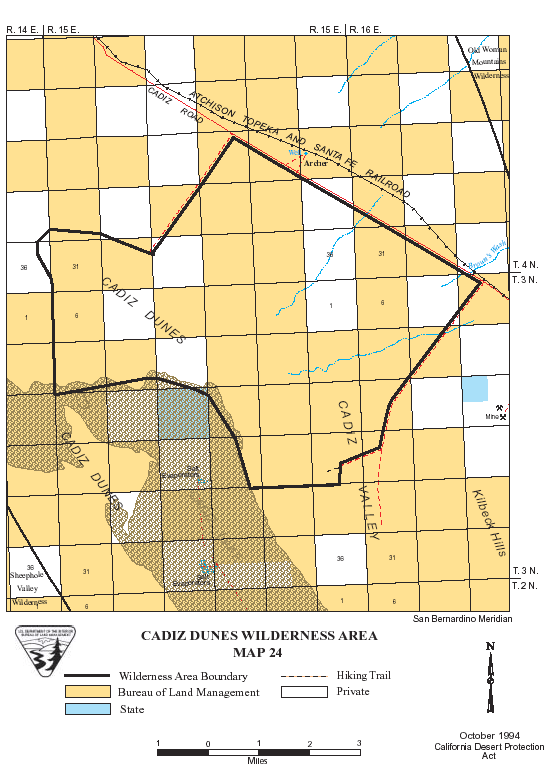
Cadiz Dunes >> Map #24
Cadiz Dunes Wilderness

SIZE: 39,740 acres

LOCATION: San Bernardino County; 40 miles east of Twentynine Palms, California

ACCESS: Travel 62 miles east of Twentynine Palms on State Highway 62. Turn north and follow the graveled Cadiz Road for 26 miles. The next 5 miles of the Cadiz Road forms the eastern boundary of the wilderness. Cadiz Road is passable by two-wheel drive vehicles, but the southern and northern bound routes require four-wheel drive vehicles.


Intro:: Nature:: Map:: Parks:: Points of Interest:: Ghosts & Gold:: Communities:: Roads & Trails:: People & History:: BLOG:: Weather:: :?:: glossary
Digital-Desert : Mojave Desert
Country Life Realty
Wrightwood, Ca.
Mountain Hardware
Wrightwood, Ca.
Canyon Cartography
G.A. Mercantile


Grizzly Cafe
Family Dining


Abraxas Engineering
privacy

Disclaimer: Some portions of this project were developed with assistance from AI tools to help reconstruct historical contexts and fill informational gaps. All materials have been reviewed and fact-checked to ensure accuracy and reliability, though complete precision cannot be guaranteed. The aim is to provide dependable starting points and distinctive perspectives for further study, exploration, and research.

These materials are historical in nature and intended for educational use only; they are not designed as travel guides or planning resources.
Copyright - Walter Feller. 1995-2025. All rights reserved.