Digital-Desert : Mojave Desert
Intro:: Nature:: Map:: Parks:: Points of Interest:: Ghosts & Gold:: Communities:: Roads & Trails:: People & History:: BLOG:: Weather:: :?:: glossary

Wilderness - MAP
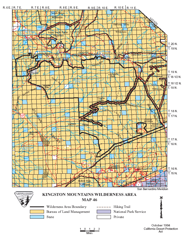
Kingston Range >> Map #46

Kingston Range Wilderness

SIZE: 209,608 acres

LOCATION: San Bernardino County; 50 miles northeast of Baker, California

ACCESS: Access the wilderness from State Highway 127; the Old Spanish Trail Highway; or the eastern boundary from the Excelsior Mine Road via Cima Road off Interstate 15 (26 miles east of Baker).


Intro:: Nature:: Map:: Parks:: Points of Interest:: Ghosts & Gold:: Communities:: Roads & Trails:: People & History:: BLOG:: Weather:: :?:: glossary
Digital-Desert : Mojave Desert
Country Life Realty
Wrightwood, Ca.
Mountain Hardware
Wrightwood, Ca.
Canyon Cartography
G.A. Mercantile


Grizzly Cafe
Family Dining


Abraxas Engineering
privacy

Disclaimer: Some portions of this project were developed with assistance from AI tools to help reconstruct historical contexts and fill informational gaps. All materials have been reviewed and fact-checked to ensure accuracy and reliability, though complete precision cannot be guaranteed. The aim is to provide dependable starting points and distinctive perspectives for further study, exploration, and research.

These materials are historical in nature and intended for educational use only; they are not designed as travel guides or planning resources.
Copyright - Walter Feller. 1995-2025. All rights reserved.