Digital-Desert : Mojave Desert
Intro:: Nature:: Geography & Maps:: Parks & Preserves:: Points of Interest:: Ghosts & Gold:: Communities:: Roads & Trails:: People & History::

Wilderness - MAP
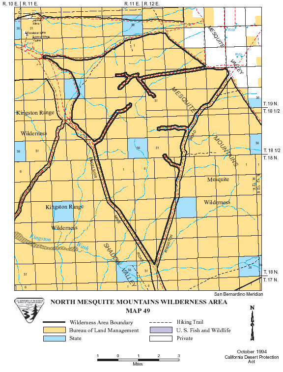
North Mesquite Range >> Map #49

North Mesquite Mountains Wilderness

SIZE: 25,540 acres

LOCATION: San Bernardino County; 60 miles northeast of Baker, California

ACCESS: To access the southernmost point of the wilderness, take the Cima Road exit off Interstate 15 (26 miles east of Baker), and travel north approximately 8 miles on the paved Excelsior Mine Road until it intersects with the graveled Kingston Road. The wilderness lies between these two roads.


Intro:: Nature:: Geography & Maps:: Parks & Preserves:: Points of Interest:: Ghosts & Gold:: Communities:: Roads & Trails:: People & History::
Digital-Desert : Mojave Desert
Country Life Realty
Wrightwood, Ca.
Mountain Hardware
Wrightwood, Ca.
Canyon Cartography
G.A. Mercantile


Grizzly Cafe
Family Dining


Abraxas Engineering
privacy

For educational use only; not a travel or safety guide. Copyright (c) Walter Feller, 1995-2026. All rights reserved.