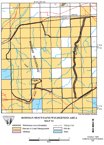
Rodman Mountains >> Map #31
Rodman Mountains Wilderness
SIZE: 27,690 acres
LOCATION: San Bernardino County; 30 miles southeast of Barstow, California
NATURAL RESOURCES: A series of ridges and valleys climbing from 2,000 feet to almost 5,000 feet are the result of faults which cross this wilderness. A lava flow slices this area in two from northwest to southeast, forming a sloping mesa. Colorful escarpments, calico-colored mountains, maze-like canyons and broad, majestic bajadas come together here. Steep canyons and cliff-like walls form dry falls along deep drainage channels, creating cascades during heavy rain storms. More than a half dozen natural water "tanks" sit within the lava flow. Two of the tanks, Hidden Tank and Deep Tank, hold thousands of gallons of water. One of only seven core raptor breeding areas in the desert is within this wilderness, where prairie falcons and golden eagles are known to survive. The mountains themselves are part of the historic range of the desert bighorn sheep. While sheep have not been spotted here, this wildlife species has been seen in the nearby Newberry Mountains.
| GLOSSARY | > bajada, canyon, lava, mesa, tank |
ACCESS: Access to this wilderness is by Camp Rock Road, from either Interstate 40 or State Highway 247.
Geomorphic Province : Mojave Desert
Ecosection : Mojave Desert
Ecosubsection : Lucerne - Johnson Valleys and Hills, Mojave Valley - Granite Mountains
Native Culture : Vanyume, Chemehuevi