|
Digital-Desert :
Mojave Desert
|
| Intro:: Nature:: Map:: Parks:: Points of Interest:: Ghosts & Gold:: Communities:: Roads & Trails:: People & History:: BLOG:: Weather:: :?:: glossary |
|
|
Wilderness - MAP 
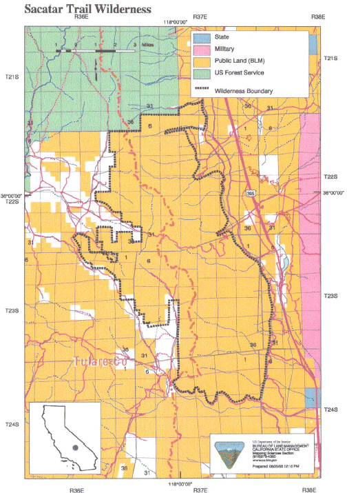
Sacatar Trail >> Map #54 Sacatar Trail Wilderness SIZE: 51,900 acres LOCATION: Inyo and Tulare Counties; 20 miles northwest of Ridgecrest, California ACCESS: Access this wilderness from the east via U.S. Highway 395 north of Inyokern and along dirt routes into Sacatar Canyon, Portuguese Canyon (four-wheel drive only), Lewis Canyon (SE93), and Tunawee Canyon; and the south via U.S. Highway 395 north of Inyokern along Ninemile Canyon Road.
|
| Intro:: Nature:: Map:: Parks:: Points of Interest:: Ghosts & Gold:: Communities:: Roads & Trails:: People & History:: BLOG:: Weather:: :?:: glossary |
|
Digital-Desert :
Mojave Desert
|
|
Country Life Realty Wrightwood, Ca. |
Mountain Hardware Wrightwood, Ca. |
Canyon Cartography |
G.A. Mercantile |
Grizzly Cafe Family Dining |
|
Abraxas Engineering privacy |
Disclaimer: Some portions of this project were developed with assistance from AI tools to help reconstruct historical contexts and fill informational gaps. All materials have been reviewed and fact-checked to ensure accuracy and reliability, though complete precision cannot be guaranteed. The aim is to provide dependable starting points and distinctive perspectives for further study, exploration, and research. These materials are historical in nature and intended for educational use only; they are not designed as travel guides or planning resources. Copyright - Walter Feller. 1995-2025. All rights reserved. |