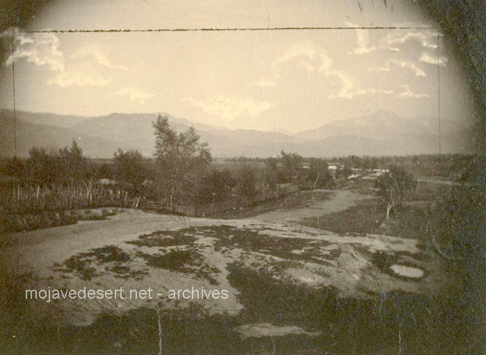
photos by Rudolph D'Heureuse
San Bernardino
Index - Next
San Bernardino
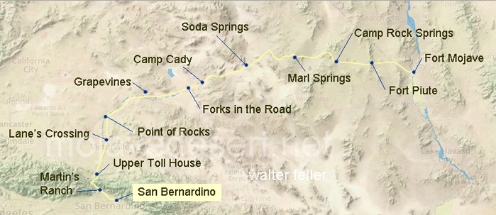
In 1863, San Bernardino was still a young inland county seat in Southern Californiaincorporated less than a decade earlier and laid out on the square-mile plan of the Mormon colony established in the early 1850s. After many Latter-day Saints returned to Utah in 1857, the town persisted as a small but important service center for the valley and the routes beyond.Its local economy leaned on irrigated farms and ranches, drawing from an older tradition of ditches and waterworks in the region. The Civil War sat in the background: Southern California had pockets of secessionist sympathy, and Union authorities maintained a watchful posture and military presence in the south of the state. For desert travel, Cajon Pass was the gateway, and San Bernardino the practical staging point before the Mojave Road carried parties east toward the Colorado River and Fort Mojaveprecisely the corridor Rudolph DHeureuse photographed in 1863.