Freeways and Highways
Modern highways in the Mojave Desert follow transportation corridors that have served travelers for centuries. Many of these routes began as Indigenous trade paths, wagon roads, railroad alignments, and early automobile trails before developing into the interstate and state highway system seen today. The desert's broad valleys, mountain passes, dry lake beds, and long distances between settlements strongly influenced the location and construction of these roads.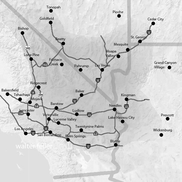
General area road map. Not all roads are shown.
One of the principal transportation routes in the Mojave Desert is Interstate 15 (I-15), which crosses the western Mojave between Southern California and Nevada. Passing through Cajon Pass, Barstow, Baker, and the Ivanpah Valley, the freeway serves as a major corridor linking the Los Angeles Basin with Las Vegas and the interior Southwest. Portions of the route parallel earlier transportation corridors, including the historic Arrowhead Trail and U.S. Route 91.
Interstate 40 (I-40) extends east-west across the eastern Mojave Desert, generally following the corridor of historic U.S. Route 66. Communities such as Needles, Ludlow, and Newberry Springs developed along this transportation route, which remains one of the principal highways connecting California with Arizona and the central United States. Long stretches of I-40 pass through open desert terrain, offering broad views of volcanic mesas, dry valleys, and distant mountain ranges.
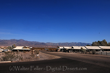
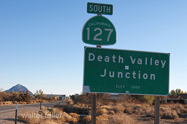
Other important highways include State Route 58 (SR-58), which connects Barstow with Bakersfield through Tehachapi Pass, and State Route 127 (SR-127), which runs north from Baker toward Death Valley Junction and the Nevada border. These highways provide access to remote desert communities, mining districts, recreational areas, and national park lands.
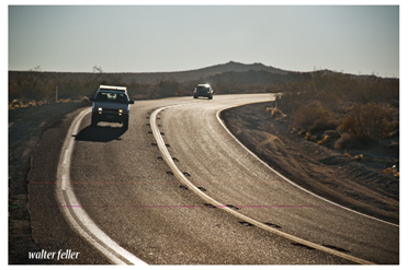
Road construction and maintenance in the Mojave Desert present unique challenges. Extreme summer temperatures, flash flooding, high winds, and blowing sand can rapidly damage pavement and reduce visibility. Engineers and maintenance crews must account for shifting desert conditions, isolated terrain, and long distances between service centers.
Because many Mojave highways pass through sparsely populated regions, fuel stations, rest areas, and emergency services are often widely spaced. Travelers have traditionally been advised to carry extra water, monitor vehicle conditions carefully, and prepare for long stretches without services, particularly during the summer months.
Modern highways have greatly increased access across the Mojave Desert, supporting commerce, tourism, and regional travel. At the same time, many of these roads continue to reflect the geography and historic travel corridors that shaped movement through the desert long before the automobile era.
Interstate 15
Interstate 40
U.S. 395
State Route 2
State Route 14
State Route 18
State Route 38
State Route 58
State Route 62
State Route 127
State Route 136
State Route 138
State Route 173
State Route 178
State Route 190
State Route 247
State Route 247 - Old Woman Springs Highway