Digital-Desert : Mojave Desert
Intro:: Nature:: Geography & Maps:: Parks & Preserves:: Points of Interest:: Ghosts & Gold:: Communities:: Roads & Trails:: People & History::

Wilderness - MAP
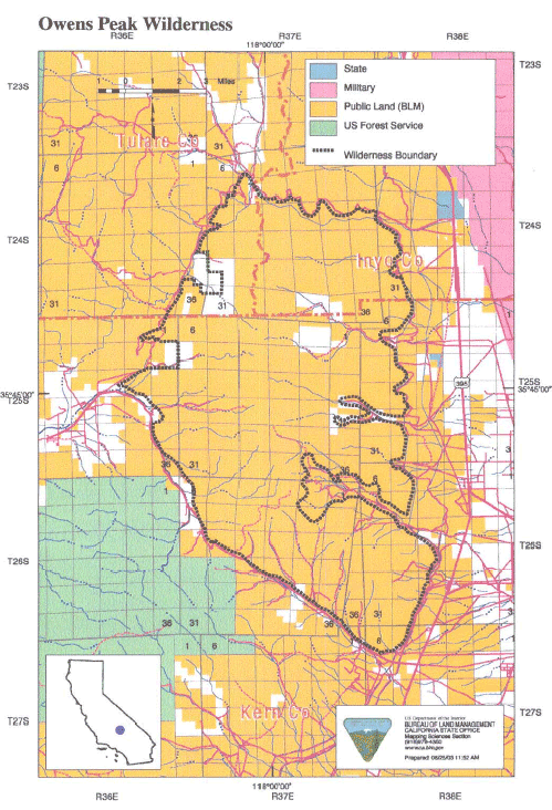
Owens Peak >> Map #51

Owens Peak Wilderness

SIZE: 74,640 acres

LOCATION: Kern, Tulare and Inyo Counties; 15 miles northwest of Ridgecrest, California

ACCESS: Access this wilderness from the south via Canebrake Road, off State Highway 178; from the east via U.S. Highway 395 north of Inyokern and along four-wheel drive- recommended routes into Indian Wells Canyon, Short Canyon, Sand Canyon, and No Name Canyon; and from the north via U.S. Highway 395 north Inyokern along Ninemile Canyon Road.


Intro:: Nature:: Geography & Maps:: Parks & Preserves:: Points of Interest:: Ghosts & Gold:: Communities:: Roads & Trails:: People & History::
Digital-Desert : Mojave Desert
Country Life Realty
Wrightwood, Ca.
Mountain Hardware
Wrightwood, Ca.
Canyon Cartography
G.A. Mercantile


Grizzly Cafe
Family Dining


Abraxas Engineering
privacy

Some content is based on reconstructed historical context and has been reviewed for accuracy; interpretation may evolve. For educational use only; not a travel or safety guide. Copyright © Walter Feller, 1995–2026. All rights reserved.